The Wanderings of Ulysses
About the Section
"The Wanderings of Ulysses", the second section of Ulysses, is comprised of twelve chapters, four of which we analyzed. The four sections we worked with are:
In these four chapters, we encoded 95 locations, which are included on the left.
Considering the homeric parallel, we can remember that the sections of The Odyssey that most closely correlate with the chapters in "Wanderings" are the ones where Odysseus is trying to get home, while running into, for example, the Cyclops or the Oxen of the Sun. Therefore, we can see in "Wanderings" that Bloom and other characters are walking around the city of Dublin, trying to get back home. For this reason, the number of settings in chapters taken from "Wanderings" is much greater than the number of settings taken from either "The Telemachiad" or "The Homecoming."
Most Common Allusions
The most common allusions in "The Wanderings of Ulysses" were references to Catholicism, to Christianity, and to Jesuits. There were 37 references to Catholicism, 17 references to Christianity, and 5 references to Jesuits.
There were 378 total allusions coded in "Wanderings."
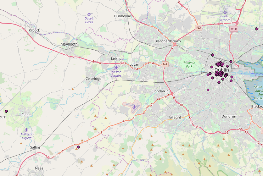
Map
The following map is a map of the locations of the "Wanderings" section. Most of the locations, visible on the map as purple dots, are centered in Dublin. While we have listed most of these to the side, due to time constraints we were unable to create separate pages for every location. However, several of them, such as Island Street or The Coombe, are finished and are examples of what we hope will be all of the locations listed to the side in the future.
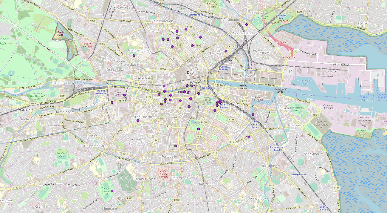
Here is a map more zoomed into Dublin for clarity:
Here is a map zoomed in to the Liffey area:
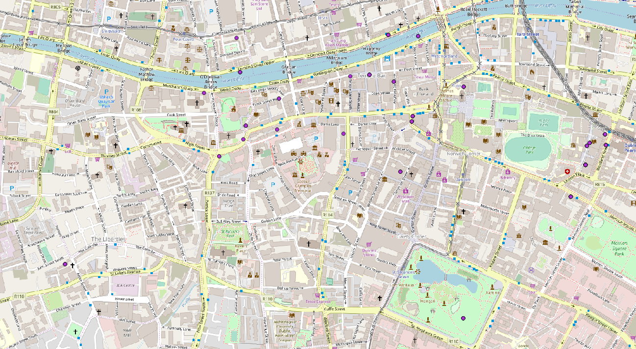
Here is a map zoomed into the Pearse Street area:

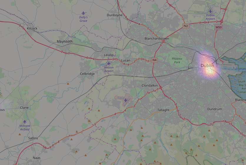
The following heatmap displays the concentration of allusions, weighted by the most common allusions. The heatmap has been zoomed into Dublin so as to feature the most prominent locations as decided by allusion concentration. Within the Dublin locations, 7 Eccles Street and College Green are the locations where the allusions are most strongly prominent, because they are the lightest purple areas of the map.
Network Graph
The following network graphs links allusions to locations in "The Wanderings of Ulysses".

From the network graph, we can see that there are many locations featured in "Wanderings," 95 separate ones to be exact. This means that the network graph is more complex, especially when compared with a simpler-looking network graph, such as the one featured on the "Homecoming" page. However, I believe that even though it isn't pretty, the network graph from "Wanderings" still provides interesting and useful information about the section. Using the magnifier to zoom, we can see that, of all of the locations, the most references are made in 7 Eccles Street and 46 Westland Row, because those are the largest locations surrounded by the largest circles of allusions. However, we can also note that there are two subnetworks within the larger networks: one subnetwork in which 46 Westland Row is prominent and another in which 7 Eccles Street is prominent. The circles designating allusions are sized by closeness centrality, which means that the allusions "closest" to the locations are the largest. Closeness is determined by how strongly correlated the allusion is with the location. Moreover, the circles designating allusions are colored according to degree, which means that the allusions that are referenced the most often and in the most locations are lighter-colored than the allusions that are referenced fewer and in fewer places. As you can see, some of the most commonly referenced allusions, such as Catholicism, are some of the lightest colored circles.